
Updated Framework Masterplan
You said, we listened
Following consultation on the Gibfield Park framework masterplan in March 2026, the proposals have been updated to reflect feedback from residents, stakeholders and elected members. Peel Land remains committed to delivering the site, while ensuring local input helps shape a scheme that supports the existing community and its future ambitions.
In response to your feedback, clear guidelines (also known as Development Parameters) have been introduced to help shape the development of the site. These set limits on how close buildings can be to existing homes, along with controls on their size and height, to provide reassurance to the community. This is the update to the masterplan that we are reconsulting on at this stage.
It is important to note that the principle and broad location of homes and employment space at Gibfield Park were established through the Places for Everyone plan, following several stages of public consultation between 2016 and 2024. The changes consulted on related to how the site could come forward, rather than introducing a new location for employment development.
Use the slider to compare the previous framework masterplan with the revised framework masterplan. Sliding the arrows to the right will display the previous plans and sliding the arrows to the left will show the updated plans.
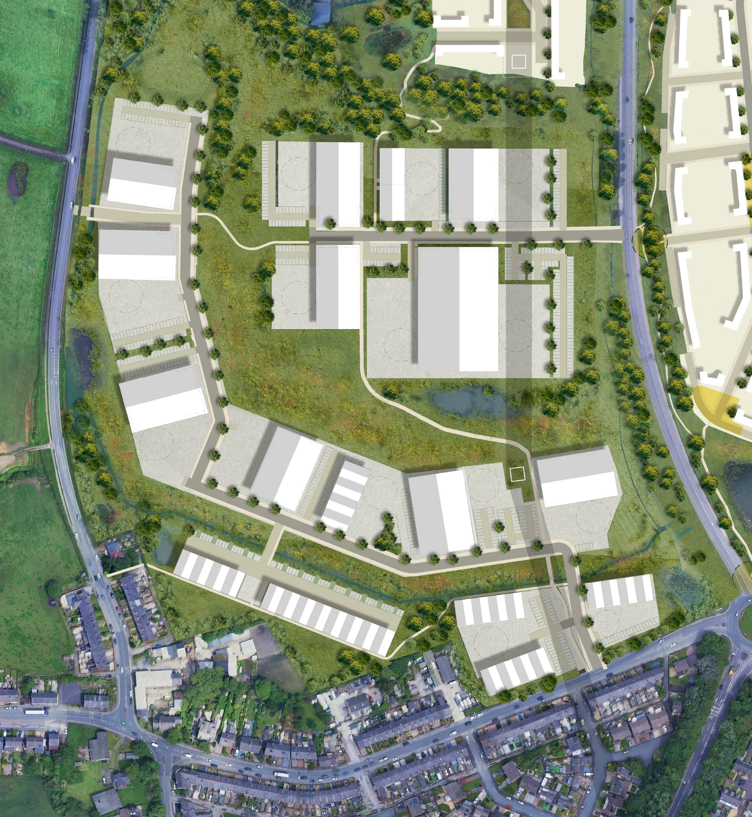
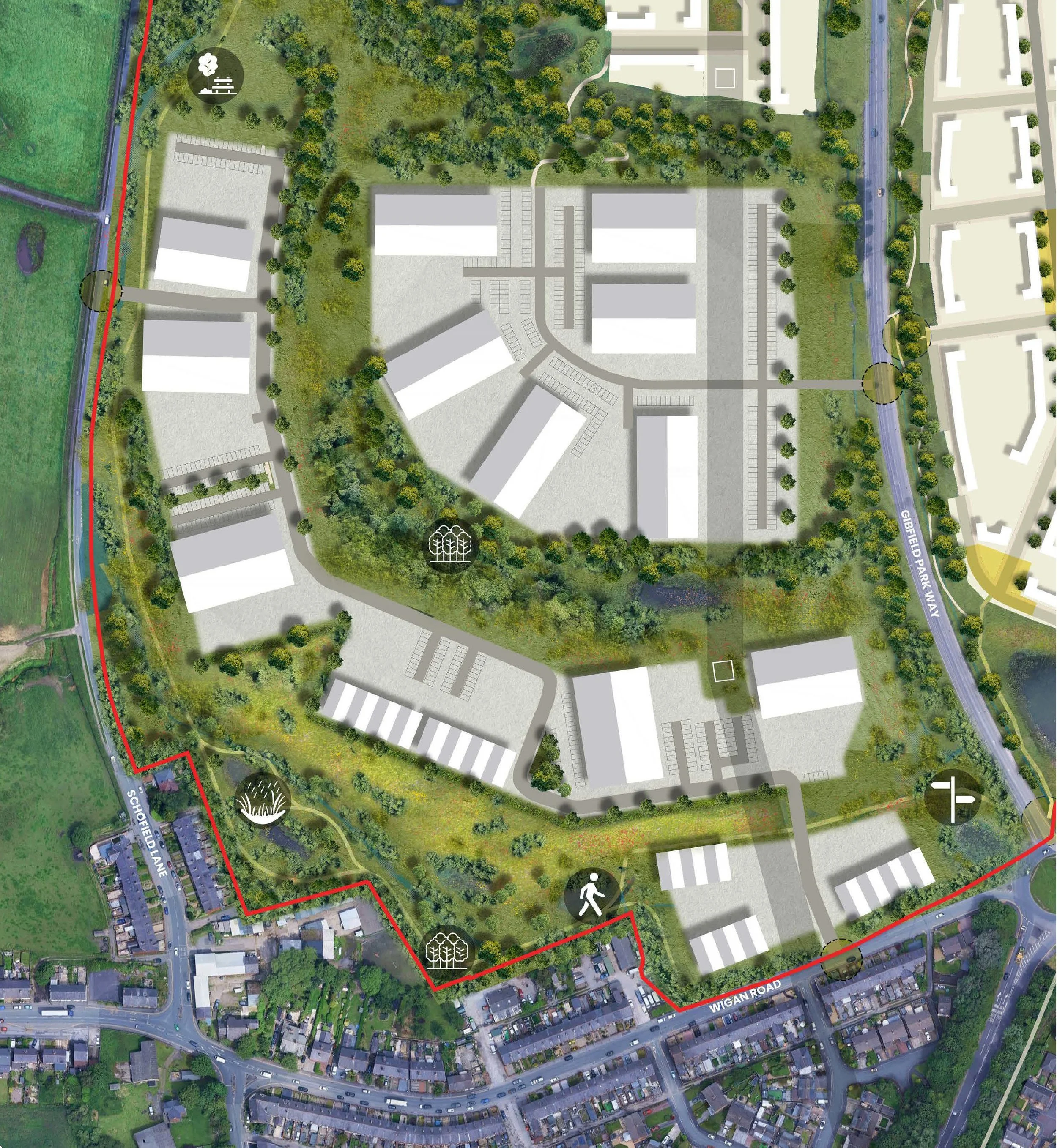
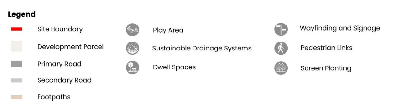
Use the slider to compare the previous framework masterplan with the revised framework masterplan.
Illustrative map showing the separations distances between proposed employment units and prosperities along Wigan Road and Schofield Lane (click to enlarge)
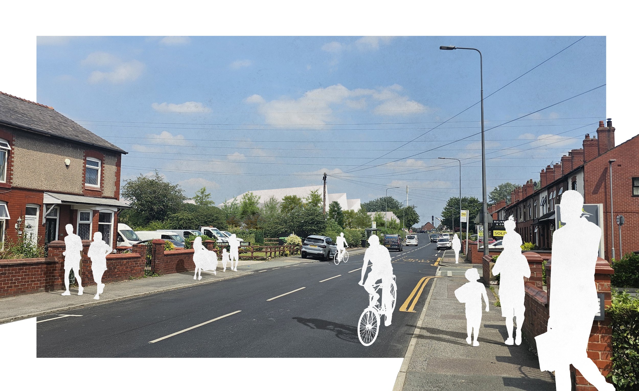
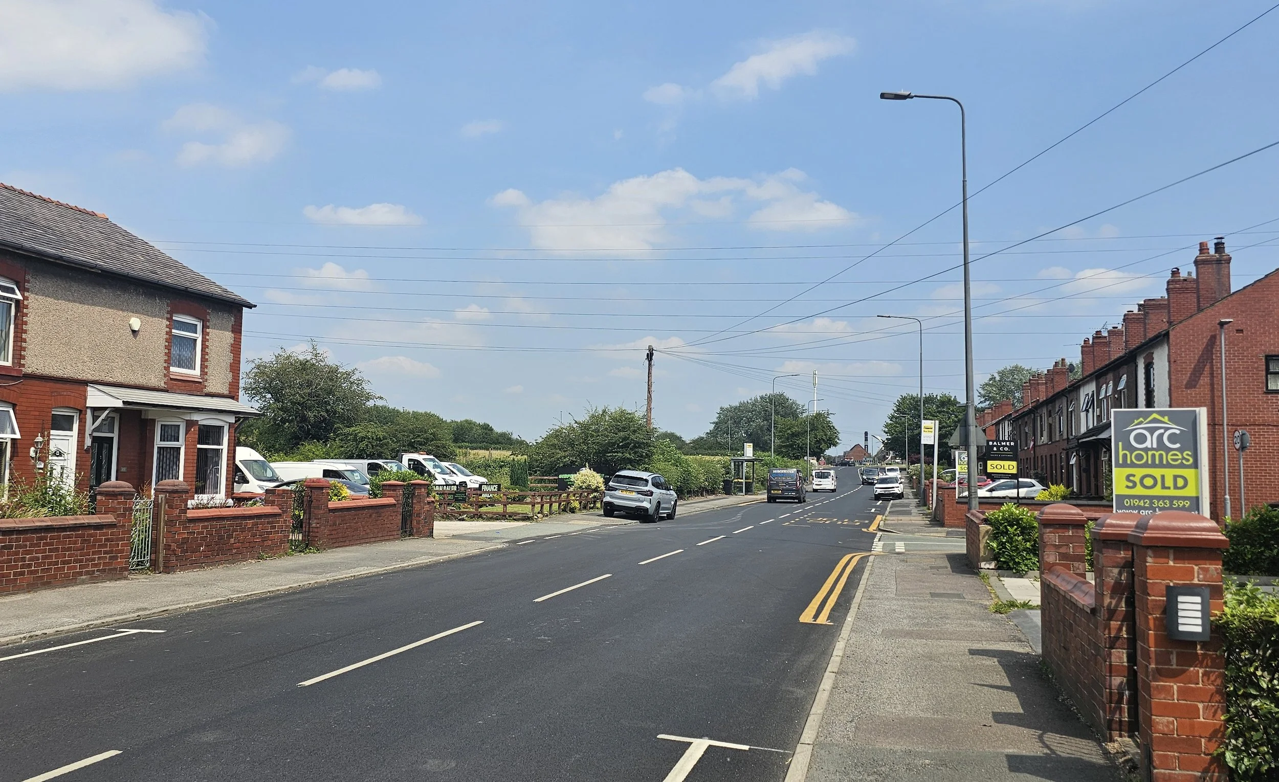
Use the slider to view an artists impression of the before and after looking east along Wigan Road
Distance between new buildings and nearby properties
Your feedback
Most of the feedback received during the previous consultation focused on the southwestern part of the site, where employment development is proposed. Residents raised concerns about the proposed buildings being too close to existing homes on Schofield Lane and Wigan Road, their size, and the impact they could have on views from neighbouring properties.
Our revised masterplan proposals
The revised framework masterplan includes around 35,000sqm of employment space located between Gibfield Park Way and Schofield Lane, reduced from 45,500sqm in the previous proposals following feedback received earlier this year.
The employment area remains in the same broad location identified through the Places for Everyone process and has been refined through the Framework Masterplan in response to community feedback.
Greater flexibility has also been introduced so that, subject to future planning applications, some of the employment space could instead come forward as additional homes and a local centre if this is shown to be appropriate over time.
A Development Parameter has now been introduced that sets back any new buildings by at least 65 metres from the rear of properties along Schofield Lane and Wigan Road and at least 30m from the front of properties along Wigan Road. Development would no longer be permitted in the area that previously proposed the row of single-storey employment units.
Boundary screening and planting
Your feedback
Feedback highlighted that people felt the scale of the proposed employment buildings had the potential to overshadow properties along Schofield Lane and Wigan Road.
Our revised masterplan proposals
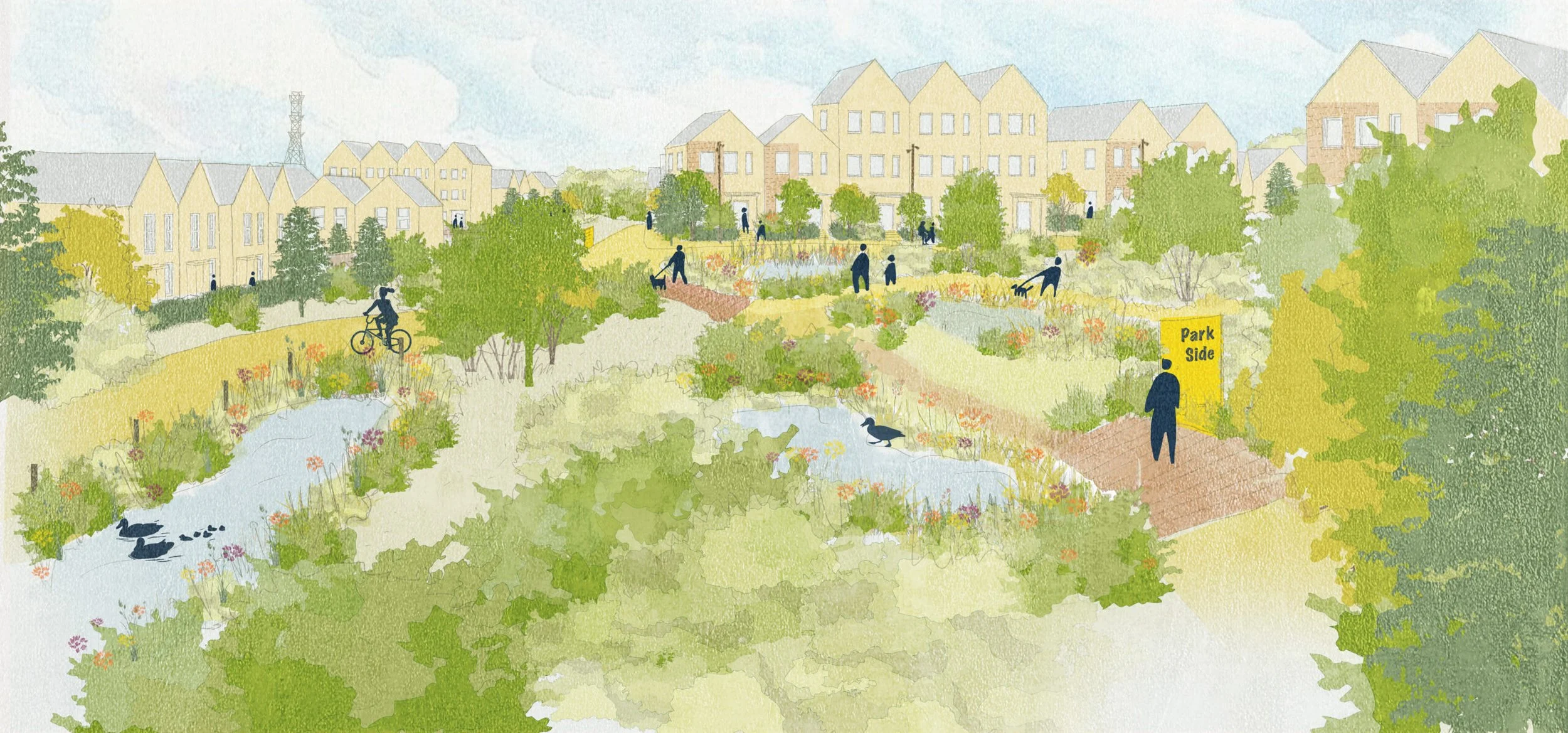
A new green corridor has been introduced to the rear of properties along Schofield Lane and Wigan Road. Around the size of three football pitches, it will include new trees and hedgerows to help separate existing homes from future development.
The outline planning application for Phase One also proposes to use the area that was previously identified for a row of single-storey employment units for new planting and ecological improvements. This will help create more space for nature while further reducing the visibility of development from neighbouring homes.
Scale of development
Your feedback
The framework masterplan consulted on earlier this year did not define building scale or indicate building heights. Feedback suggested that some people felt the proposed employment buildings had the potential to be too large for the location.
Our revised masterplan proposals
The revised framework masterplan now includes maximum building heights for future employment development. Buildings closest to Wigan Road would be no higher than 11 metres, while buildings elsewhere within the employment area would be no higher than 12.5 metres. This is similar in height to the three-storey townhouses on Broadleaf Drive at Popple Fold.
What other feedback did we receive?
Alongside comments about the proposed employment area, people also shared views on topics including traffic, local services, wildlife, flooding, the future link road, construction impacts and the need for new homes.
These comments have all been reviewed and continue to inform the proposals. Many relate to technical matters that are being assessed through detailed studies, including transport, ecology, drainage and environmental assessments, which will accompany future planning applications.
As a result, they have not led to further changes to the revised framework masterplan at this stage.
Consulting on the revised framework masterplan and Phase One together allows people to comment on both the long-term vision for Gibfield Park and the first phase of development. Progressing Phase One also enables more detailed technical work to be completed early and allows the new green corridor to be delivered and established before future employment development comes forward.
The Green Corridor
Click to enlarge and view how the Green Corridor will establish a green link between the developments to the south and the Country Park.
The Green Corridor will be delivered as part of Phase One, giving planting time to mature before any employment development comes forward. Covering an area equivalent to around three football pitches, it will provide a substantial green buffer between existing homes and future development. The Green Corridor will include layered planting, with new trees, shrubs and wildflower areas to support biodiversity and create an attractive landscape setting.
Artist’s impression of a bird’s eye level view looking south east (click to enlarge)
Where is the gas pipeline and what does it mean for the proposals?
A high-pressure gas pipeline runs through the southern part of Gibfield Park. For safety reasons, the Health and Safety Executive (HSE) sets rules about the types of development that can take place nearby.
This means that homes cannot be built in the area closest to the pipeline. However, outside this area there is more flexibility, meaning future development could include new homes, employment space that creates new jobs, or a mix of both, subject to future planning applications.
Since the draft Framework Masterplan was consulted on earlier this year, the HSE has updated its safety guidance. This means a smaller part of the site is now affected by these restrictions, providing greater flexibility for future development outside the closest safety zone.
The Health and Safety Executive (HSE) has defined COMAH (Control of Major Accident Hazards) zones for this pipeline. Residential development is not permitted within the inner COMAH Zone, but employment development can be located here. The COMAH Zones on Gibfield Park were changed by the HSE in spring 2026. The change has allowed for the potential inclusion of some residential development within Schofield Parkway and so this is presented as an option for consultation.
Click to enlarge and view the path of the gas pipeline in the context of the proposed development
The broad location of homes and employment space at Gibfield Park has formed part of the site's allocation through the Places for Everyone plan since it was first consulted on through the Greater Manchester Spatial Framework. The updated Framework Masterplan does not introduce a new location for employment development; instead, it reflects changes made in response to community feedback and updated HSE guidance.
Employment option (click to enlarge)
Homes option (click to enlarge)
Indicative building heights
To help show the proposed building heights and spacing, click the icons on the interactive map to view the relevant cross-sections
NorthFold – Wigan-Bolton Growth Corridor
Gibfield Park is not a standalone development; it forms part of NorthFold, one of six strategic growth corridors identified across Greater Manchester to deliver coordinated, long-term growth. Spanning Wigan and Bolton boroughs, NorthFold has been established to plan development in a joined-up way, unlocking investment and infrastructure at a scale that would not be achievable through individual sites coming forward in isolation. The corridor has already attracted more than £1 billion in public and private investment, and is intended to enable major transport improvements, alongside new homes, employment space, and wider regeneration across both boroughs.
The corridor is underpinned by strategic transport investment, including the proposed M6–M61 link road. This investment is intended to improve connectivity across the sub-region, address long-standing congestion issues and create the conditions for sustainable economic growth. Within this wider framework, Gibfield Park plays a key role by enabling the extension of Gibfield Park Way, which forms part of the safeguarded route for the M6–M61 link.
Bringing forward Gibfield Park will help unlock critical infrastructure required along the route, including investment in new railway crossings to reduce congestion and improve connectivity between West Atherton and Westhoughton. In this context, the site is integral to delivering the wider NorthFold vision, rather than a standalone proposal.
Do Gibfield Park Way and a new railway link bridge have funding?
NorthFold is a wider plan across Bolton and Wigan to coordinate new homes, jobs and transport improvements over time, including future road connections. As part of this, a long-term new road connection is planned between the M61 and M6, which would be delivered in stages alongside growth across the area. The route also forms part of Transport for Greater Manchester's approved transport plan and Greater Manchester's wider infrastructure pipeline. Some sections already exist, some have planning permission and funding in place, and others are still being developed.
In March 2026, almost £70 million of funding was announced through the Greater Manchester Good Growth Fund for delivery of the Park Avenue link road in Bolton. This will create a new connection north of the railway line and forms part of the wider route.
At Gibfield Park, the proposals include safeguarding land for a future extension of Gibfield Park Way and delivering a section of the route within the site. This would help enable future connections further north, including across the railway line.
A business case for delivery of the bridge is being actively worked on, led by Wigan Council in partnership with Network Rail, Transport for Greater Manchester, Greater Manchester Combined Authority, Bolton Council and Peel Land. A further funding submission is expected later this year.
This means the full route is not funded today, but work is underway and parts of the wider infrastructure network are already being delivered.
-
Major infrastructure such as new highway links is usually funded through a combination of public and private investment, rather than from one single source. Public funding is often sought where a scheme can demonstrate wider benefits, such as improving connectivity, reducing congestion, supporting economic growth and unlocking new homes or employment land.
Infrastructure and growth are closely linked and are typically delivered together over time. While people often ask why infrastructure cannot be delivered first, in practice infrastructure of this scale usually depends on development to help make it possible. New development can provide land, deliver sections of infrastructure directly, contribute funding through planning obligations and help create the case for wider public investment.
Without growth, there is often no viable mechanism to fund or deliver infrastructure at this scale. This is why strategic sites are planned to bring forward development and infrastructure in phases, so investment and delivery can happen together over time.
What community contributions will the development be obligated to make?
Planning obligations are legal agreements between a developer and the local council that help ensure new developments contribute positively to the local area. They can require developers to provide or fund things such as affordable housing, improvements to roads and public transport, new green spaces, community facilities, education provision, or healthcare infrastructure. Planning obligations are used to address the impacts of a development and help create sustainable, well-supported communities. They are negotiated as part of the planning application process and are secured through a legally binding agreement.
Peel Land is in discussions with Wigan Council about contributions that would be made as part of Gibfield Park. This is subject to ongoing discussions but is expected to include:
School places -Discussions with the Local Education Authority are ongoing to assess the capacity of local schools. If the development is expected to create additional demand, contributions may be secured to provide extra school places where required.
Healthcare - The local NHS Integrated Care Board has advised that there is currently no identified need for a new GP surgery. However, contributions may support improvements to existing healthcare facilities to help meet the needs of the growing community.
Open space and recreation - Phase 1 will deliver the Green Corridor. Each phase will also contribute to the delivery of the Country Park, ensuring it is created alongside the development.
Highways and sustainable transport - Each planning application will include measures to address that phase's transport impacts. This is expected to include contributions towards improvements to the local highway network where required, including increased junction capacity and other highway infrastructure to support the development. This may include improvements at the Wigan Road/Gibfield Park Way roundabout and contributions towards the proposed link road to the north, subject to ongoing discussions and the planning process. The masterplan also includes new footpaths and cycleways, enhanced crossing facilities and other measures to improve connectivity and encourage sustainable travel.
The vision for Gibfield Park
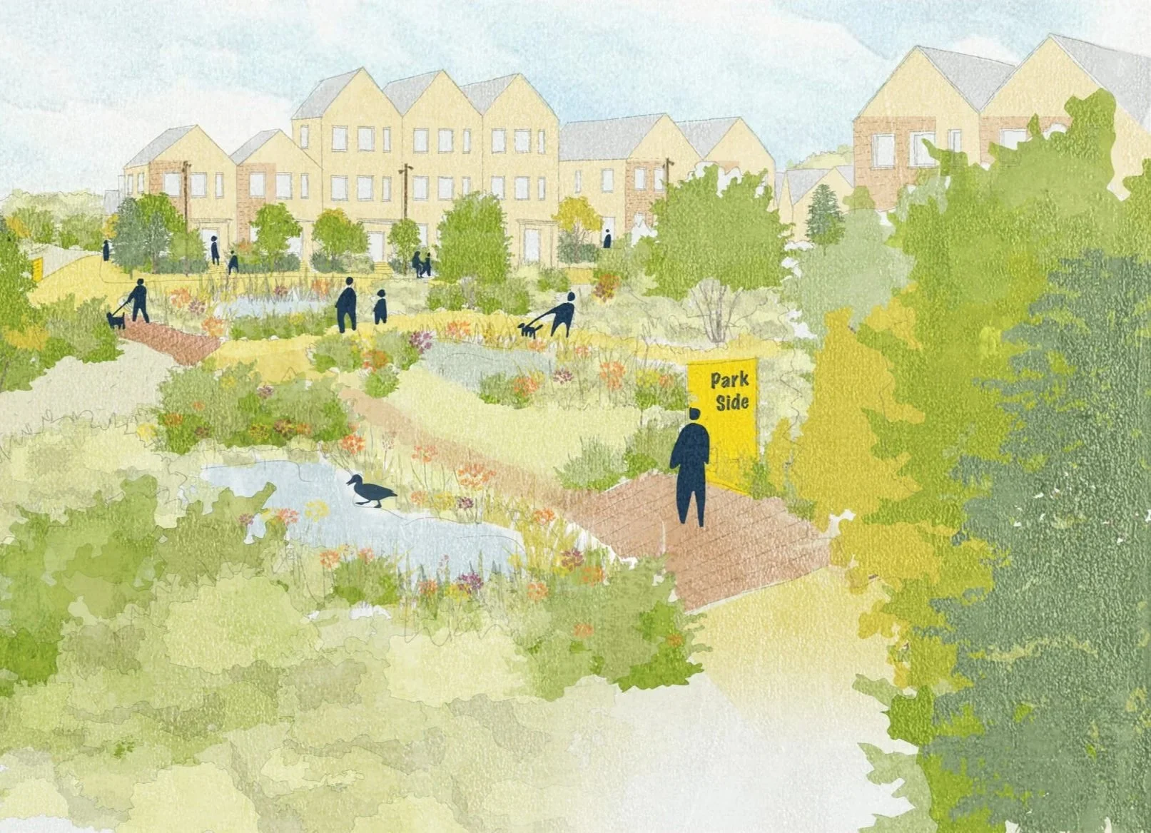
Illustrative image of the northern section of Gibfield Park
Building on the site’s allocation for development, the vision for Gibfield Park is to deliver welcoming, well-connected neighbourhoods that are integrated with the existing communities.
Gibfield Park will create a thriving new neighbourhood, bringing together a mix of homes, including 25% affordable, new jobs and a 29-hectare Country Park, all seamlessly connected through enhanced infrastructure including the extension of Gibfield Park Way.
The masterplan for the site has been influenced by a number of existing features, including landscape and ecological features, established and emerging residential areas, employment and industrial areas, as well as significant road and rail infrastructure. These all combine to help inform how development can come forward across the Site to create a co-ordinated and comprehensive development.
Distinct character areas would help ensure that each part of Gibfield Park responds to its particular surroundings, landscape and existing features. Each area would have its own identity while complementing the character of the wider development and creating high-quality residential and mixed-use neighbourhoods.
Gibfield Country Park will be a key driver in creating a new recreational and ecological destination for Gibfield Park and its future users, as well as for the benefit of existing surrounding residential neighbourhoods.
Vision Diagram (click to enlarge)
The framework masterplan proposes around 500 new homes, including policy-compliant affordable housing, which will help meet housing needs identified in Wigan through the adopted Places for Everyone Plan. Gibfield Park has already been allocated through this process and forms part of Wigan's planned housing supply to help meet local needs.
Homes are proposed across two main areas of the site, accessed from Gibfield Park Way (around 200 homes) and North Road (around 250–300 homes), and would come forward in phases over time.
The current proposals for Gibfield Meadows (Phase One) include 25% affordable housing.
Click on the eye icons to explore the different character areas across Gibfield Park and learn more about each one.
-
Gibfield Park has been allocated through the adopted Places for Everyone plan to help meet housing needs in Wigan and support the delivery of homes over the long term. The site allocation identifies capacity for around 500 homes as part of a wider mix of homes, jobs, green space and infrastructure.
The proposed number of homes reflects the scale of the allocated site and helps support delivery of wider benefits alongside development, including road improvements and the proposed Country Park.
The framework masterplan currently proposes around 500 homes across the site.
What happens next?
All feedback is currently being carefully reviewed and considered before the revised framework masterplan is finalised and submitted to Wigan Council.
At the same time, feedback on Phase One (Gibfield Meadows) will help inform the outline planning application before it is submitted to Wigan Council. If approved, work on Phase One is currently expected to begin from around 2028.
Future phases of homes and employment space would come forward through separate planning applications over time, with further opportunities for community engagement as proposals are developed. Gibfield Park is currently expected to be delivered in phases over around 10 years, with all phases anticipated to be completed by around 2037.